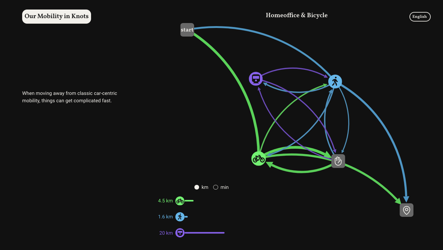
Our Mobility in Knots
Visualising mobility networks - Mapping Cities, Making Cities
This project takes an unusual look at the mobility data of Potsdam citizens. We developed a way to show mobility in a network format. This allows a focus on the mode of transportation and interconnectedness, instead of focusing on paths and distances.
https://ourmobilityinknots.netlify.app
For the implementation, I used Python and Networks to process the data, and Vue.js, D3, and Scrollama to create the website. The codebase is in this git repo: https://github.com/johannahaha/website_mapping_maas
I developed this project together with Helmut Büttner (Narration) and Sascha Höver (Design) as part of the Mapping Cities – Making Cities by Prof. Dr. Marian Dörk at University of Applied Sciences Potsdam, Winter semester 2021/22. Our data and project partner was the MaaS L.a.b.s. of the University of Applied Sciences Potsdam.